
China's Landscape: A Comprehensive Overview
Mountain Ranges and Plateaus
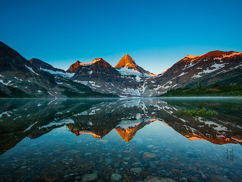
China is home to several major mountain ranges that significantly influence the country's climate and ecology. The Himalayas in the southwest, bordering Tibet, are perhaps the most famous. This mountain range includes Mount Everest, the highest peak in the world. The Kunlun Mountains, another important range, stretch across the western part of China and are known for their harsh climate and rugged terrain.
The Tibetan Plateau, often referred to as "the Roof of the World," is the largest and highest plateau globally. This vast elevated region has an average elevation of over 4,500 meters (14,800 feet) and is crucial for the climate patterns of Asia. The plateau is characterized by its cold, arid conditions and is the source of several major rivers, including the Yangtze, Yellow, and Mekong.
In the northeast, the Greater Khingan Range and the Lesser Khingan Range form a significant part of China's northern landscape. These ranges are less rugged but still contribute to the diverse climatic and ecological conditions of the region.
Deserts and Steppes
China also encompasses some of the world's largest deserts. The Gobi Desert, located in northern China and southern Mongolia, is known for its extreme temperature variations and sparse vegetation. The Gobi's arid conditions make it a challenging environment for both flora and fauna.
To the west lies the Taklamakan Desert, one of the largest sand deserts in the world. It is situated in the Xinjiang Uyghur Autonomous Region and is known for its vast, shifting sand dunes and extremely dry climate. The desert's harsh conditions have shaped the cultures and lifestyles of the people who live around it.
The Ordos Desert in Inner Mongolia is another significant arid region. Unlike the Gobi and Taklamakan, the Ordos Desert is characterized by its more diverse topography, including both sand dunes and rocky outcrops.
Rivers and Lakes
China's rivers and lakes are vital to its agriculture, industry, and daily life. The Yangtze River, the longest river in Asia, flows from the Tibetan Plateau through central China to the East China Sea. The Yangtze Basin is one of China's most fertile regions, supporting a significant portion of the country's population.
The Yellow River, known as "China's Sorrow" due to its frequent flooding, originates from the Bayan Har Mountains in Qinghai and flows across northern China to the Bohai Sea. Its basin is also crucial for agriculture, especially for wheat cultivation.
In addition to these major rivers, China is home to several large lakes, including Poyang Lake and Dongting Lake, both of which play crucial roles in flood control and water supply. Lake Baikal, although primarily located in Russia, extends into the northeastern part of China and is one of the world's deepest and oldest freshwater lakes.
Coastal Areas
China's coastline stretches for approximately 14,500 kilometers (9,000 miles), making it one of the longest coastlines in the world. This extensive coastline features a variety of landscapes, from the sandy beaches of Hainan Island in the south to the rugged cliffs of the Shandong Peninsula in the east.
The Bohai Sea, located in northern China, is the innermost gulf of the Yellow Sea. It is a crucial area for shipping and trade, with major ports such as Tianjin and Qingdao located along its shores.
In the south, the South China Sea is known for its warm waters, rich marine biodiversity, and strategic importance. The sea's numerous islands and coral reefs contribute to its ecological richness, supporting a diverse array of marine life.
Climate Zones
China's climate is equally diverse, ranging from the temperate conditions of the north to the subtropical and tropical climates of the south. The northern regions, including areas like Beijing and Harbin, experience cold winters with temperatures often dropping below freezing. In contrast, southern cities such as Guangzhou and Hong Kong enjoy mild winters and hot, humid summers.
The monsoon influences much of China's climate. The summer monsoon, originating from the Indian Ocean, brings heavy rainfall to the eastern parts of China, including the Yangtze River Basin. In contrast, the winter monsoon, coming from the north and northwest, brings cold, dry air to the northern regions.
Ecological Diversity
China's diverse landscape supports a wide range of ecosystems, from temperate forests in the north to tropical rainforests in the south. The country's vast natural reserves are home to numerous species of plants and animals, many of which are endemic.
In the mountainous regions, such as the Himalayas and the Kunlun Mountains, you can find unique flora and fauna adapted to high altitudes and extreme conditions. The Tibetan antelope and the snow leopard are examples of animals that thrive in this harsh environment.
The forests of southeastern China, including the Yunnan-Guizhou Plateau, are known for their biodiversity. The region's rich vegetation supports a variety of wildlife, including the giant panda, which is native to the mountainous areas of Sichuan.
Conclusion
China's landscape is a testament to the country's geographical and ecological diversity. From the towering peaks of the Himalayas to the arid expanses of the deserts, from the fertile river valleys to the rugged plateaus, China's natural environment is both varied and awe-inspiring. Understanding this diverse landscape not only highlights the beauty of China but also underscores the importance of preserving its unique ecological heritage for future generations.
Top Comments
No Comments Yet